South Fork, Colorado

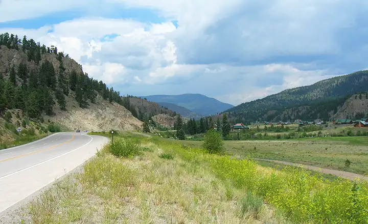
Coming to South Fork from the east

South Fork, one of Colorado's newest incorporated towns, is located at the confluence of the Rio Grande and its' South Fork, on the western side of the San Luis Valley, just downstream from where the Rio Grande and the South Fork both emerge from the San Juan Mountains. At the intersection of US Highway 160 and Colorado Highway 149 in the center of town is the South Fork Visitor Center and the Interpretive Center for the Silver Thread, marking the southern end of Colorado's Historic Silver Thread Scenic Byway. The Silver Thread travels north and passes Creede before coming to the headwaters of the Rio Grande as it winds its way through the San Juans. When the Rio Grande finally heads west into the Weminuche Wilderness, the Silver Thread continues north past Clear Creek Falls and over Slumgullion Pass, past the Slumgullion Earthflow and Lake San Cristobal to Lake City and then further north to the Blue Mesa Reservoir and Curecanti National Recreation Area, on the West Elk Loop just west of Gunnison.
Although South Fork initially developed as a service community for the lumber and mining industries in the area, it has now evolved into a rapidly growing tourist and recreational mecca. The opening of the highly acclaimed 18-hole Rio Grande Golf Club really added to the local attractions.
For the fishermen there are 47 tributaries and 500 miles of fishing streams between South Fork and the far headwaters of the Rio Grande. An example is the Coller State Wildlife Area on the Rio Grande, just a few miles north of South Fork via Highway 149. There are also 13 good fishing lakes accessible by car or short hikes within 20 minutes of town.
Hiking, biking, river rafting, and horseback riding are among the main activities taken up by summer visitors. Winter brings ice fishing, snowmobiling and cross-country skiing with 165 miles of maintained trails. And a lot of folks come just to ski Wolf Creek (The Most Snow in Colorado).
With a good variety of shops, restaurants and accommodations, South Fork provides a perfect base for day trips to the historic mining towns of Creede and Lake City with their museums and the famous Creede Repertory Theater. There are 2 narrow gauge railways nearby and incredible opportunities for wildlife viewing.
"Kamp Komfort," the setting of the 1983 movie National Lampoon's Vacation was 3 miles outside of South Fork at the Riverbend Resort.

South Fork Town Hall
Unlike South Fork's rough and tumble neighbors to the north, Lake City and Creede, which developed into towns overnight, South Fork gradually developed over the past century, first into a lumber center and then into the tourism center it is now. Prior to the arrival of the Denver and Rio Grande Railroad in November, 1882, South Fork was a stopping point on the stage line from Monte Vista and Del Norte on the way to Wagon Wheel Gap, Creede and Lake City. The railroad, however, brought profound change: cheap, reliable transportation allowed the residents to exploit the great timber resources of the area. Sawmills were built and trainloads of finished lumber have been shipped from South Fork for years.
Agriculture in the area also expanded with the coming of the railroad. A large amount of the rich agricultural land between South Fork and Del Norte was brought into production with cauliflower, lettuce and peas.
Today, the saw mills in South Fork are still busy. The San Luis Valley is a major agricultural region. And South Fork is in the heart of a booming tourism/outdoorsman/skiing area. The future is looking pretty bright.

The Silver Thread Interpretive Center at the intersection of US 160 and SR 149, downtown South Fork

The Rio Grande through South Fork in January, 2008

Along the Rio Grande north of South Fork

Coming to South Fork from Wolf Creek Pass
Rio Grande County Related Pages
Center - Del Norte - Monte VistaSouth Fork - Rio Grande County
Silver Thread Scenic Byway - Rio Grande National Forest
Monte Vista National Wildlife Refuge