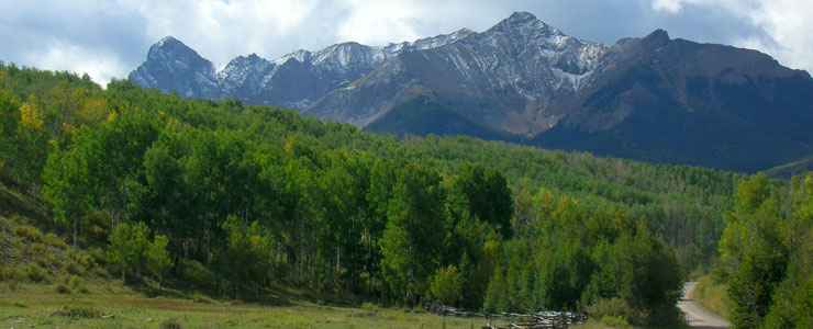
Mount Sneffels Wilderness

One of the roads to Mount Sneffels Wilderness
Mt. Sneffels Wilderness is more than 16,500 acres on Uncompahgre National Forest near the communities of Telluride, Ouray and Ridgway. Elevations range from 9,600' to 14,150' at the top of Mount Sneffels. Mount Sneffels itself, one large intrusion of igneous rock, was supposedly named by members of the Hayden Survey for an Icelandic mountain made famous in Jules Verne's "Journey to the Center of the Earth" (Sneffels is Nordic for snowfield). From the photo above you can see that this is a landscape dominated by ragged peaks, icy slopes and serrated ridges. Climbing here is dangerous because of the loose and "rotten" volcanic rock. The central part of the Wilderness is extremely rugged and hardly ever visited. But if you're looking for sheer mountain wonder, come here in the fall when the aspens are in color and there's a dusting of fresh snow on the peaks and ridges...
There are about 15 miles of trails within the Mt. Sneffels Wilderness, including the Blue Lakes, Alder, Dallas Whipple Mountain, and Deep Creek Trails. The Sneffels Highline Trail starts near Telluride and extends north into the Wilderness. Blue Lakes and Mount Sneffels receive high visitor use and probably should be avoided on weekends and holidays. Campsites in the Blue Lakes area are limited in number and campfires are prohibited there. There are jeep tour operators based in Ouray who offer tours into Yankee Boy Basin if you want to get close enough to touch but not so close as to camp there.
Photo courtesy of TheArmchairEplorer, CCA-by-SA 3.0 License
Map courtesy of National Geographic Topo!