Greenhorn Mountain Wilderness

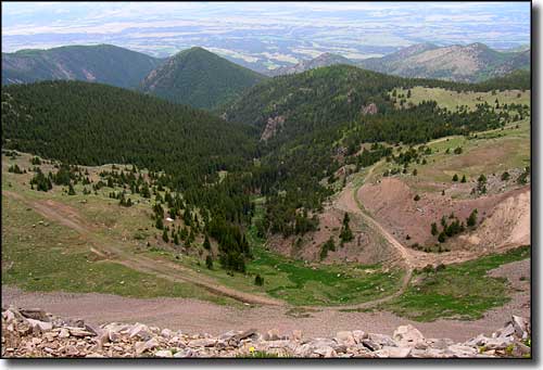
Looking south from Greenhorn Peak in Greenhorn Mountain Wilderness

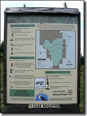
Greenhorn Mountain Wilderness, comprising some 22,040 acres in the southern Wet Mountains, came into being through an Act of Congress in 1993. Once upon a time there were homesteads and cattle ranches in some areas out there but over time, they were abandoned and this land was incorporated into the Wet Mountains section of the San Isabel National Forest. These days there's no mechanized vehicles allowed, which includes mountain bikes and hang gliders. Except for the igneous intrusion that forms and fills the upper rock faces of the Greenhorn Peaks, this area of the Wet Mountains is built on glacier-carved and eroded formations of 1.8 billion-year-old granite. The rock of the Peaks themselves plus Santana Cone and Badito Cone are from one igneous intrusion, about 25 million years ago (about the same time as the nearby Spanish Peaks and Mt. Mestas-Silver Mountain-Sheep Mountains intrusions).
There's about 11 miles of trails crossing the Wilderness and most of those trails are in the northern half of it. The southern half of this property is remote, rugged and essentially waterless. If you're looking for a place to get away from it all and still have some extraordinary views, this should be close to the top of your list, especially if you're going to be here for sunrise: watching that line of light move down the Sangre de Cristo's to the west is simply magical.
Directions: We went to the Ophir Creek Turnoff, just north of Bishop's Castle on State Highway 165 and went west on Forest Road 360 to the intersection with the Gardner Road (FR 634). There we turned left on FR 369 and followed that to the trail head at the end of the road. It is a long road with many twists and turns and you don't even see Greenhorn Mountain itself until you are almost on it. There are quite a number of hiking trails leading off along the way and all of it looks gorgeous. Some folks access the wilderness by going to the KOA campground in Rye and climbing the trail that leads up from there.

Looking down on the Bartlett Trail from the summit of Greenhorn Mountain

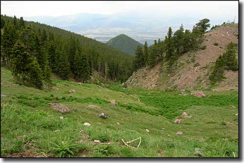
A valley descending the west side of Greenhorn Mountain Wilderness

The heart of Greenhorn Mountain Wilderness
Map courtesy of National Geographic Topo!
Trails in Greenhorn Mountain Wilderness
The Bartlett Trail in Greenhorn Mountain Wilderness is about 12.1 miles long and is rated as moderately difficult. It sees its heaviest use in summer and early fall.
- Trail beginning: 8,000'
- High Point: 11,580'
- Trail ending: 11,580'
Access: The lower trailhead is at the edge of Rye, southwest of State Route 165. Go through Rye on Main Street, turn left on Boulder, left again on Graneros Road, then right on Hunter and right again on Baxter to the trailhead. Or, take SR 165 to Ophir Creek Forest Service Road #360. Go west for about 12 miles and then turn left on Greenhorn Mountain Road, go 17 miles to the parking area at the end of the road. Most of the Bartlett Trail is in the Wilderness Area, so wilderness rules and regs apply (especially no mechanized vehicles, including mountain bikes and hang gliders).
Notes: If hiking from the Rye end of the trail, it's a long way up to the junction with the South Apache Trail on the southern shoulder of Greenhorn Mountain. At that junction, if you go north you'll come to the other trail head for Bartlett. If you go south, you'll go deeper into the Wilderness Area. The Bartlett Trail skirts the upper part of Greenhorn Mountain by staying south and west of the upper mountain.
USGS Maps: Rye, San Isabel
This trail is 7.8 miles of almost constant rise, but is officially rated as moderate in difficulty. It sees most traffic in summer and fall.
- Trail beginning: 7,460'
- High Point: 12,000'
- Trail ending: 11,340'
Access: The east trailhead is just out of Rye, southwest of Highway 165 (go through Rye on Main Street and then turn right on Cuerna Verde Road, go to the end). The west trailhead is at the end of Greenhorn Mountain Road at the edge of the Greenhorn Mountain Wilderness.
Notes: From east to west, the Greenhorn Trail rises up into the Greenhorn Mountain Wilderness and crosses a saddle between the North Peak (12,220') and the South Peak (12,347') of Greenhorn Mountain (there are actually several high points at the top of the rock but this trail goes right across between them and then descends the western rock face on a good but very rocky trail). The views: superb... but don't go here on a windy day.
USGS Maps: Rye, San Isabel
This moderately difficult, 6 mile trail drops into the southwestern corner of the Wet Mountains through Greenhorn Mountain Wilderness. Most folks hike this trail in the summer and fall.
- Trail beginning: 11,400'
- High Point: 11,400'
- Trail ending: 8,200'
Access: From State Road 165, turn west at Ophir Creek onto FR 360. At the intersection below Deer Peak, turn south on FR 369 (the Greenhorn Mountain Road) and go to the end of the road (this is a longer distance than you might think because of the way this road just winds around and keeps on going). The parking area is on a shelf with of the Huerfano Valley and Sangre de Cristo's to the west.
Notes: At the end of FR 369 is the Greenhorn Mountain Wilderness (so wilderness rules and regs apply). Follow the signs for the Bartlett Trail (head off south/southeast into the trees and not up the hill onto Greenhorn Mountain itself. Bartlett is an easy hike for the first few miles as it works its way along the bottom of the rock face of upper Greenhorn and then southeast across the "deck" of the Wet Mountains. About 4 miles in you'll come to the signed junction with the Santana Trail. Turn southwest and have a good time. The Santana Trail ends at private property so you'll be coming back over the same route.
USGS Maps: San Isabel, Badito Cone
The South Apache Trail is a hard, 4.3 mile drop off the eastern side of Greenhorn Mountain Wilderness. The trail ends at private property so the only way out is to go back up that relentless hill. Folks who hike this route do it in the summer and fall.
- Trail beginning: 9,600'
- High Point: 9,600'
- Trail ending: 7,300'
Access: On State Highway 165, turn west at Ophir Creek Road (FR 360). Go about 12 miles and then turn left (south) on the Greenhorn Mountain Road. Go another 17 miles to the end of the road at the edge of Greenhorn Mountain Wilderness.
Notes: At the parking area at the end of the road, follow the signs for the Bartlett Trail. Follow the Bartlett Trail south for about 5 miles to the junction with the South Apache Trail. Go right and follow the trail down the hill paralleling South Apache Creek.
USGS Maps: San Isabel, Rye, Badito Cone, Hayden Butte