Lone Peak Wilderness

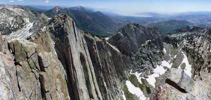
View from the summit of Lone Peak
Located in that scenic backdrop along the Wasatch Front southeast of Salt Lake City, the 30,088-acre Lone Peak Wilderness is an area of very rugged terrain with high peaks and steep, narrow canyons. Elevations range from about 5,000' to the summits of Lone Peak (11,253') and Little Matterhorn (11,326'). The higher areas of Lone Peak Wilderness are alpine with exposed rocky ridges, large cirque basins and a few small lakes. The lower elevations and south-facing slopes are covered with dense mountain brush and grasses while the higher, north-facing slopes carry isolated stands of aspen, subalpine fir and Douglas fir.
The northern boundary of Lone Peak Wilderness is along Little Cottonwood Canyon, which separates Lone Peak from the Twin Peaks Wilderness to the north. The southern boundary is along State Route 92 and State Route 144 as they pass through American Fork Canyon and separate Lone Peak Wilderness from the Mount Timpanogos Wilderness to the south. Most of the trails that enter Lone Peak Wilderness have trail heads along these roads.
There are 14 trails that run for about 46 miles through Lone Peak Wilderness. Some of these trails are reasonably easy to hike but many are quite strenuous and rated moderate to severe. Because of the proximity to Salt Lake City, Lone Peak Wilderness sees reasonably heavy human use all year round.
USGS Quads: Timpanogos Cave, Draper and Dromedary Peak

Related Pages
Camp Floyd-Stagecoach Inn State Park
Deer Creek State Park
Fivemile Pass OHV Area
Flight Park