Little Jacks Creek Wilderness

Little Jacks Creek Wilderness

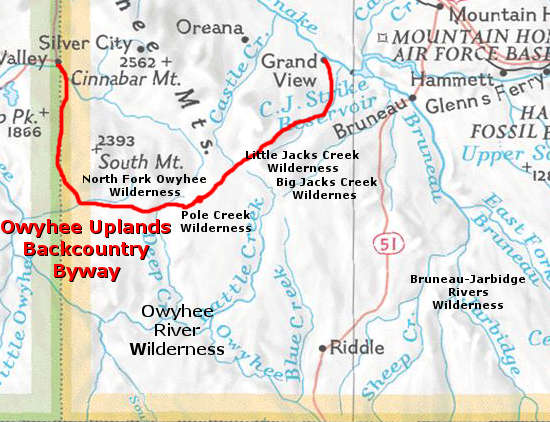
Little Jacks Creek Wilderness contains some 50,929 acres of land in the Little Jacks Creek drainage. About 12.4 miles of Little Jacks Creek is classified as "wild river." The Little Jacks Creek Wilderness is separated from the Big Jacks Creek Wilderness to the southeast by a pipeline and the maintenance road that runs along it.
The centerpiece of Little Jacks Creek Wilderness is a large, sagebrush-and-grass covered basalt dome cut deeply by ancient water flows. Some of the canyon walls approach 1,000' in height as they rise directly up from small, dense riparian areas along the perennial streams.
The best season to enjoy the Little Jacks Creek Wilderness is fall, when things cool off a bit and the summer rainy season is over. By mid-November, though, it's getting too cold and snow will have often started flying.
Little Jacks Creek Wilderness is in the Owyhee Desert, part of the Basin and Range physiographic province.

Little Jacks Creek Wilderness in winter

Photos and big map courtesy of the Bureau of Land Management
Related Pages
Map courtesy of National Geographic Topo!