Talladega Scenic Drive

Cheaha Lake, from the top of Cheaha Mountain
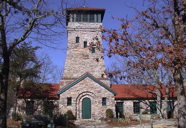
The Talladega Scenic Drive is a 29-mile route through Talladega National Forest. The road travels along the upper ridges of both the Horseblock and Cheaha Mountains at the extreme southern end of the Appalachian Mountain Range. The route begins just out of Heflin and ends at Adams Gap, with a side road in the middle that allows you to summit Cheaha Mountain (2,407' - highest point in Alabama) and enjoy the view from Bunker Tower, a Civilian Conservation Corps-built structure with an observation deck on top. The summit is part of the popular Cheaha State Park. Just to the east and south of the state park (and mountain summit) is the Cheaha Wilderness.
When the route that is now the Talladega Scenic Drive was first being contemplated, it was a much longer drive (and mile markers along the road reflect that). However, since the route between Heflin and Adams Gap has been paved, construction on any other aspect of the drive has ceased. There is a dirt road leading south from Adams Gap that was supposed to be the future route of the Talladega Scenic Drive but it sees very little traffic.
One thing about the Talladega Scenic Drive: it seems to be a lot higher in elevation than it is because the surrounding countryside is so much lower and the views are so expansive... but this route takes you to the best in recreational opportunities in this part of Talladega National Forest.

Bunker Tower on top of Cheaha Mountain
Photo of Bunker Tower courtesy of Ryan Cragun
