Ellicott Rock Wilderness

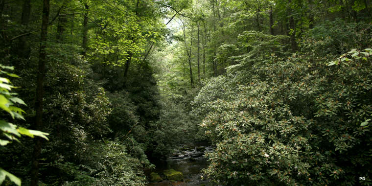
Along the East Fork of the Chattooga River in Ellicott Rock Wilderness

Ellicott Rock Wilderness sign
Ellicott Rock Wilderness is an 8,296-acre property that straddles the point where Georgia, South Carolina and North Carolina meet. The wilderness also straddles the boundaries of Sumter National Forest, Nantahala National Forest and Chattahoochee-Oconee National Forest. About 2,857 acres is in South Carolina, about 3,416 acres in North Carolina and about 2,023 acres in Georgia. The wilderness is also bisected by the Chattooga Wild and Scenic River.
The name comes from a surveyor named Andrew Ellicott who ventured into the woods back in 1811 and located the point at which Georgia and North Carolina come together. He then chiseled that location into the face of a rock just above the Chattooga River waterline. Another expedition came along years later and decided to chisel their findings into a rock about 10 feet to the south, a rock protruding from the river just above normal waterline. That rock is named "Commissioners Rock." Getting to either of the rocks requires wading or fording the river, something that no one recommends as the river is quite treacherous in the area and has swallowed more than a few victims.
Highest point in the wilderness is Glade Mountain (3,672') in Georgia. Fork Mountain (3,294') is the highest summit in the South Carolina section of the wilderness. Terrain in most of the wilderness is steep and rugged. The Chattooga River drops about 280 feet in its crossing of the wilderness. Precipitation is plentiful and frequent, averaging about 80 inches per year. The forest understory is dense with dog hobble and impassable stands of rhododendron.
Much of the forest was logged in the early part of the 20th century but those operations are quickly fading into the background as the second-growth forest retakes what was lost in the early days of the Euro-American invasion.

The inscription on Ellicott's Rock, outlined in red chalk

The inscription on Commissioner's Rock