Bureau of Land Management Sites in Montana
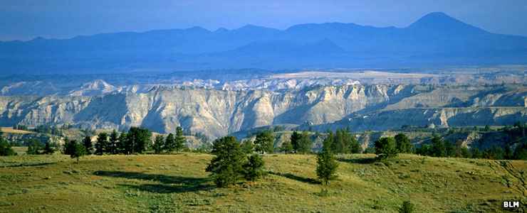
Upper Missouri River Breaks National Monument
National Monuments
Wilderness Areas
Backcountry Byways
Recreation Areas
Wilderness Study Areas
- Antelope Creek
- Axolotl Lakes
- Beaver Meadows
- Bell and Limekiln Canyons
- Big Horn Tack-On
- Billy Creek
- Bitter Creek
- Black Sage
- Blacktail Mountains
- Bridge Coulee
- Burnt Lodge
- Burnt Timber Canyon
- Centennial Mountains
- Cow Creek
- Dog Creek South
- East Fork for Blacktail Deer Creek
- Elkhorn
- Ervin Ridge
- Farlin Creek
- Henneberry Ridge
- Hidden Pasture Creek
- Hoodoo Mountain
- Humbug Spires
- Musselshell Breaks
- North Fork Sun River
- Pryor Mountain
- Quigg West
- Ruby Mountains
- Seven Blackfoot
- Sleeping Giant/Sheep Creeks
- Square Butte
- Stafford
- Terry Badlands
- Twin Coulee
- Wales Creek
- Woodhawk
- Yellowstone River Island
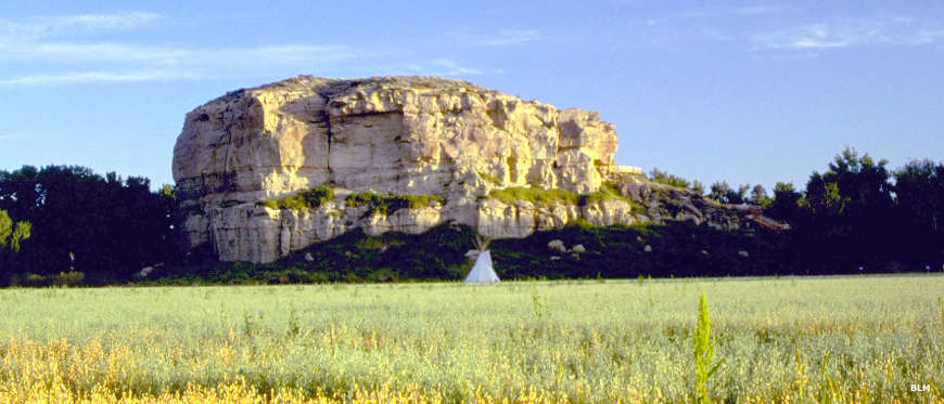
Pompeys Pillar National Monument

BLM Sites in western Montana
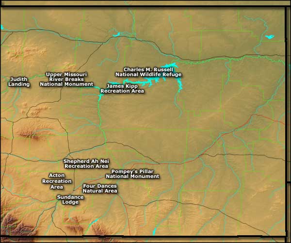
BLM Sites in eastern Montana
Photos are courtesy of the Bureau of Land Management
Maps courtesy of Cartesia MapArt US Terrain