Devils Elbow Recreation Area

The Devil's Elbow Campground
The Devil's Elbow Campground is a popular, 42 site campground located on Hauser Lake between the Two Camps Vista Interpretive Site and the Clark's Bay day use area, about 15 miles east of Helena. There are boat slips, a boat dock, restrooms, a swimming area, a fish cleaning station (for the walleye, kokanee and trout you catch), a group picnic shelter, drinking water, an on-site manager and 42 camping units with fire rings, picnic tables and garbage collection. Everything is universally accessible.
Fees are charged from mid-May through mid-October but the site is open year-round.
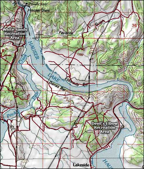
Access: Get off the I-15 at exit 193 (Cedar Street) and go east on Washington Street past the airport entrance to Canyon Ferry Road. Turn right on Canyon Ferry Road and go about 1/2 mile, then turn left on York Road. Go about 12 miles down York Road through Lakeside until you come to the Devil's Elbow Campground entrance sign.
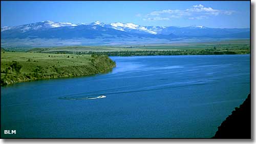
Hauser Lake
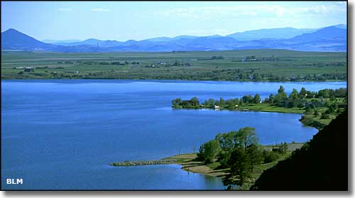
Hauser Lake

Devil's Elbow Campground
Photos courtesy of the Bureau of Land Management
Map courtesy of National Geographic Topo!
Map courtesy of National Geographic Topo!
Related Pages
Map courtesy of National Geographic Topo!