Jarvis Island National Wildlife Refuge

Coral at Jarvis Island National Wildlife Refuge

Remains of the guano tramway
Jarvis Island National Wildlife Refuge is a 429,853-acre property located about 1,305 nautical miles south of Honolulu in the mid-Pacific. Like Baker and Howland Islands to the west, Jarvis Island sits atop a volcanic seamount that rises steeply from the ocean floor. As the island is virtually on the equator, the equatorial undercurrent flows from the west and when it hits that steep slope, the nutrient-rich waters are forced upward into the sunlit zone where they feed a wide assortment of flora and fauna. That upwelling is especially strong at Jarvis due to the larger size of the island and it supports large continuous maps of soft corals and large schools of fish that live on plankton.
The first recorded sighting of the island was in 1821 by the British ship Eliza Frances, owned by the brothers Thomas, Edward and William Jarvis. The first recorded commercial venture on the island began shortly after the passing of the Guano Act in 1856 and the incorporation of the American Guano Company in 1857. Several structures were built on the island in 1858, including a two-story eight-room house with decks and verandas. A tramway was also built to move mined guano to the western shore where it was transferred to boats and then ships for the voyage to market. The island was suddenly abandoned in 1879, leaving about 8,000 tons of mined guano in a pile near the beach. There were sporadic attempts to resume the mining operation but that didn't take hold again until 1886. Then mining was continuous until 1899.

In 1935 the US reclaimed the island and, to fortify that claim, a number of young Hawaiians were recruited to settle on Jarvis, Baker and Howland Islands. That project began in 1935 but ended in the face of Japanese attacks in early 1942 when the surviving settlers were evacuated to Hawaii.
The next major visitation to the island was during the International Geophysical Year, 1957-58. A scientific expedition arrived on Jarvis and set up camp only to have a severe storm pass by in January 1958. The storm wiped away all traces of the buildings at the guano diggings and whatever had been left by the settlers. When the National Wildlife Refuge was declared in 1974, all that was left of human visitation were the guano tramway, the house built by the scientists in 1957, a small beacon built on the western shore and mounds of trash.
In 2009 Jarvis Island National Wildlife Refuge was expanded to include the submerged areas up to 12 nautical miles from the coast. About the same time, the 429,853-acre property (of which 1,273 acres is land) was included in the Pacific Remote Islands Marine National Monument. Today Jarvis Island is closed to the public, entry is by permit only. US Fish & Wildlife officers visit every 2 or 3 years, various scientific expeditions visit every now and then, sometimes teaming up with FWS to reduce the costs: the island is accessible only by boat.
The island is surrounded by a fringe of shallow reef but off to the east is a broad submerged reef terrace. About 50% of that submerged surface is growing live coral with moosehorn and rose corals dominating. As of 2006 researchers had identified 62 species of corals on the reef, 59 of them stony corals. Table and staghorn corals are rare in the mix but their numbers are growing. Heavy wave action limits the growth of corals in the shallower areas. Live coral inhabits about 1/3 of the shallow slopes off the southern and western coasts of the island, the shores where the wave action is least. However, several submersible dives off the west coast of the island found abundant deep sea life and many corals growing in the zone between 200 and 1,000 meters down. There are 14 species of birds nesting on the island, including about 1 million sooty terns. About 250 species of fish have been identified in the waters around the island, including large densities of sharks, manta rays and sea turtles.

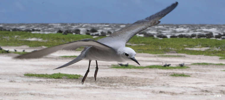
A blue grey noddy above the sand at Jarvis Island


Pacific Remote Islands Marine National Monument map