Santa Fe National Historic Trail

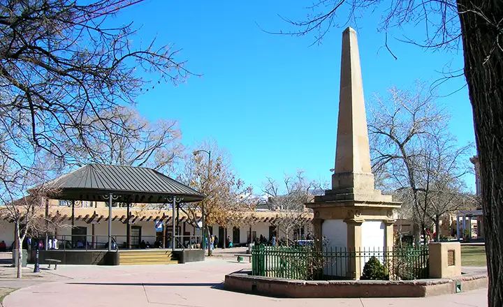
The Santa Fe Plaza, end of the trail
In September, 1821, William Becknell left Franklin, Missouri and headed west with a wagonload of goods to sell. As he was on the verge of bankruptcy, this was a desperate gamble on his part. Rumors had reached Missouri of a revolution in Mexico, a revolution in which the Spanish had been tossed out and the new Mexican government was opening its borders to trade. Becknell wanted to be the first Missouri trader to reach Santa Fe with goods of value. For many, many years, Santa Fe had been at the northern end of a long trade route stretching south to El Paso, then Chihuahua, then Mexico City. At the end of more than a thousand miles of hard travel, Santa Fe had always gotten the dregs, the leftovers. In those days, the only durable goods Northern New Mexico had to offer the world were furs, and lots of them. Becknell's gamble paid off: he made it to Santa Fe and sold his goods for a significant amount of Spanish/Mexican gold. He sold his wagon, bought a good horse, stuffed the gold in his saddlebag and headed back to Missouri. He went back by a different route, what came to be called the "Cimarron Cutoff." The Cimarron Cutoff was shorter, considerably drier and worked best for folks traveling as a pack train or on horseback. It was not a good wagon route, especially after the Comanche and Kiowa started harassing and killing travelers on that path. But when Becknell got back to Missouri with his gold, word got out and the race to make the run to Santa Fe was on.
In those very early days, there were more folks making the run from Santa Fe to Missouri and back than from Missouri to Santa Fe and back. In the late 1820's and early 1830's, traffic on the trail increased steadily. As time went on, most of it shifted to the longer but wetter and safer Mountain Route. The Mountain Route went up the Arkansas River to the vicinity of modern day La Junta, then headed southwest up the valley of the Purgatoire until it hit the confluence of Gallinas Creek and the Purgatoire. At that point, folks turned south and made the climb over Raton Pass, then headed southwest around the hills to Cimarron and Rayado. Beyond Rayado they continued down the edge of the Plains, passing Las Vegas and following the valley that led to Pecos Pueblo. Pecos Pueblo had already been abandoned by then but the main route continued on west through Apache Canyon and around the southern edge of the Sangre de Cristo Mountains to the Plaza in Santa Fe.
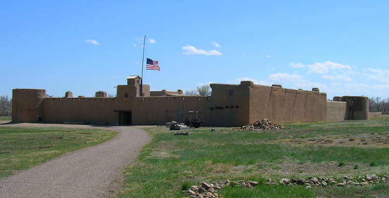
1833 saw the establishment of Bent's Fort on the north shore of the Arkansas River, between what is now La Junta and Las Animas. The Arkansas River was the international border between Mexico and the United States. Bent's Fort was the final American outpost before folks crossed the river and headed across that last 300 miles of hard travel to reach Santa Fe. When Stephen Watts Kearny came west in 1846 with his Army of the West, they spent a couple months at Bent's Fort waiting for the situation to ripen in Mexico before invading Nuevo Mexico during the Mexican War. Up until that point, the Bent brothers had been doing very well, supplying Trail travelers with necessities and trading with the local Native American tribes. But the time spent in that location by the Army of the West essentially destroyed their business and almost destroyed their reputation with the local folks. But even on the obvious edge of war, two-way travel on the Trail continued.
Kearny played some political shenanigans and eventually took New Mexico without firing a shot. The trouble in New Mexico came after his Army had moved on (the Taos Rebellion of 1847). But American traders were arriving in Santa Fe with wagonloads of goods as Kearny's troops were just leaving the south end of town headed for Albuquerque.
By 1846, Santa Fe wasn't the end of the road as many of the early traders had taken Mexican wives and were allowed to travel as far south as Chihuahua with their goods. Some (like Carlos Beaubien and Ceran St. Vrain) actually had French, Spanish and American citizenship papers.
For 20 years, American trappers and mountain men had been hanging out in Santa Fe and Taos, working for different folks who had the necessary papers to get by the Mexican tax and customs officials. Among the Americans were folks like Kit Carson, George Simpson, Lucien Maxwell and Bill Williams. Kit Carson and Lucien Maxwell married into Taoseno society, Carson marrying Josefa Jaramillo (neice of Carlos Vigil, abogado and customs officer of Taos, sometime partner of Carlos Beaubien) and Maxwell marrying Luz Beaubien (daughter of Carlos Beaubien).
With the successful (for the Americans anyway) conclusion of the Mexican War, the flood gates were thrown open and trade with Santa Fe increased exponentially. The first Fort Union was built in 1849 to protect folks on the Trail in northeastern New Mexico. By the advent of the Civil War, the Cimarron Cutoff had become so dangerous that everyone was using the Mountain Route. The city of Trinidad was established on the north side of Raton Pass in 1862, then Uncle Dick Wootton built his toll road over the Pass in 1867. In 1878 the Atchison, Topeka and Santa Fe Railroad bought his toll road and laid tracks over the hill, arriving at Lamy, about 5 miles outside of Santa Fe, in 1880, effectively signaling the end of the Santa Fe Trail.
Today, in traveling in the area, you'll find all kinds of signage and memorabilia of the era. Most of the actual trail, though, is now in private hands. There are several auto tour routes that come close to the old route. Many of the modern towns that were tiny settlements in the old days still hold Santa Fe Trail Day-type festivals and gatherings. Fort Union is now a National Monument, Pecos Pueblo and Bent's Fort National Historic Sites. Same for several places across Kansas. Rayado is a maintained location on the Philmont Scout Ranch. And Santa Fe still has a monument in the Plaza downtown marking the end of the Santa Fe Trail.

Bent's Old Fort

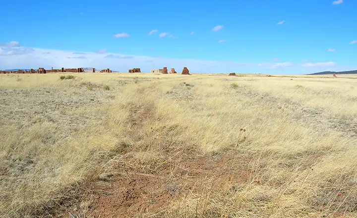
Wagon ruts on the Santa Fe Trail near Fort Union National Monument, New Mexico

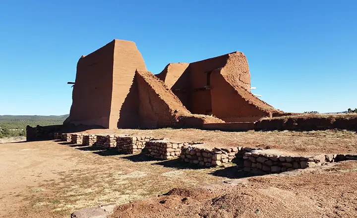
The Mission at Pecos National Historic Site
Photos courtesy of TheArmchairExplorer, CCA-by-SA 3.0 License